Algoritmos de aprendizaje automático para el mapeo de coberturas en un Área Natural Protegida
DOI:
https://doi.org/10.29298/rmcf.v17i94.1580Palabras clave:
Habilidad temática, Google Earth Engine, Olofsson, Prueba McNemar, Prueba Z, sentinel-2AResumen
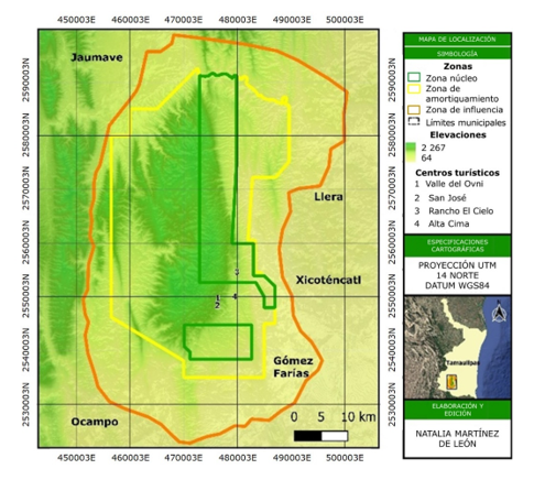
Las áreas naturales protegidas contribuyen a la conservación de la biodiversidad, la mitigación del cambio climático y brindan servicios ecosistémicos. La información precisa sobre la distribución de las coberturas y usos del suelo es fundamental para la gestión de estas zonas, y los datos de la misión Sentinel-2 son adecuados para su monitoreo. Por ello, el objetivo del estudio fue comparar el rendimiento de cuatro algoritmos de aprendizaje automático: Máquina de Vectores de Soporte (SVM), Bosques Aleatorios (RF), Árboles de Gradiente Aumentado (GBT) y Árboles de Clasificación y Regresión (CART), integrando índices espectrales y variables topográficas. Se utilizó la colección Sentinel-2 y un conjunto de muestras estratificadas para su validación (n=641). La fiabilidad temática se evaluó mediante matrices de confusión ajustadas al área. Se utilizó una prueba Z de dos proporciones para comparar los algoritmos a nivel global y una prueba chi-cuadrada de McNemar para comparar las predicciones clase por clase. Los resultados mostraron que SVM y GBT presentaron la mayor fiabilidad global de 88 % y 86 %, respectivamente. La comparación de algoritmos de la prueba Z evidenció que la mitad de los emparejamientos de algoritmos eran estadísticamente diferentes. La prueba chi-cuadrada de McNemar mostró que 46 % de las comparaciones por clase entre algoritmos pareados fueron estadísticamente significativas (p≤0.05). En conclusión, los algoritmos de aprendizaje automático permiten generar mapas precisos de cobertura y uso del suelo (CUS). Se recomienda su implementación en la toma de decisiones por su capacidad para reconocer patrones complejos.
Descargas
Citas
Abdi, A. M. (2020). Land cover and land use classification performance of machine learning algorithms in a boreal landscape using Sentinel-2 data. GIScience & Remote Sensing, 57(1), 1-20. https://doi.org/10.1080/15481603.2019.1650447 DOI: https://doi.org/10.1080/15481603.2019.1650447
Balha, A., Mallick, J., Pandey, S., Gupta, S., & Singh, C. K. (2021). A comparative analysis of different pixel and object-based classification algorithms using multi-source high spatial resolution satellite data for LULC mapping. Earth Science Informatics, 14, 2231-2247. https://doi.org/10.1007/s12145-021-00685-4 DOI: https://doi.org/10.1007/s12145-021-00685-4
Camacho-Sanabria, J. M., Juan-Pérez, J. I., Pineda-Jaimes, N. B., Cadena-Vargas, E. G., Bravo-Peña, L. C., & Sánchez-López, M. (2015). Cambios de cobertura/uso del suelo en una porción de la Zona de Transición Mexicana de Montaña. Madera y Bosques, 21(1), 93-112. https://doi.org/10.21829/myb.2015.211435 DOI: https://doi.org/10.21829/myb.2015.211435
Card, D. H. (1982). Using known map category marginal frequencies to improve estimates of thematic map accuracy. Photogrammetric Engineering and Remote Sensing, 48, 431-439. https://ntrs.nasa.gov/citations/19820041921
Cochran, W. G. (1977). Sampling techniques (3rd ed.). John Wiley & Sons. https://archive.org/details/samplingtechniqu0000coch_t4x6/page/438/mode/2up
Escandón-Calderón, J., Ordóñez-Díaz, J. A. B., Nieto de Pascual-Pola, M. C. del C., & Ordóñez-Díaz, M. de J. (2018). Cambio en la cobertura vegetal y uso del suelo del 2000 al 2009 en Morelos, México. Revista Mexicana de Ciencias Forestales, 9(46), 27-51. https://cienciasforestales.inifap.gob.mx/index.php/forestales/article/view/135 DOI: https://doi.org/10.29298/rmcf.v9i46.135
Gao, B. (1996). NDWI—A normalized difference water index for remote sensing of vegetation liquid water from space. Remote Sensing of Environment, 58(3), 257-266. https://doi.org/10.1016/S0034-4257(96)00067-3 DOI: https://doi.org/10.1016/S0034-4257(96)00067-3
Ghatkar, J. G., Singh, R. K., & Shanmugam, P. (2019). Classification of algal bloom species from remote sensing data using an extreme gradient boosted decision tree model. International Journal of Remote Sensing, 40(24), 9412-9438. https://doi.org/10.1080/01431161.2019.1633696 DOI: https://doi.org/10.1080/01431161.2019.1633696
Huete, A. R. (1988). A soil-adjusted vegetation index (SAVI). Remote Sensing of Environment, 25(3), 295-309. https://doi.org/10.1016/0034-4257(88)90106-X DOI: https://doi.org/10.1016/0034-4257(88)90106-X
Instituto Nacional de Estadística, Geografía e Informática. (2013). Continuo de elevaciones mexicano y modelos digitales de elevación [Base de datos TIFF]. Instituto Nacional de Estadística, Geografía e Informática. https://www.inegi.org.mx/app/geo2/elevacionesmex/
Keskes, M. I., Mohamed, A. H., Borz, S. A., & Niţă, M. D. (2025). Improving National Forest Mapping in Romania Using Machine Learning and Sentinel-2 Multispectral Imagery. Remote Sensing, 17(4), Article 715. https://doi.org/10.3390/rs17040715 DOI: https://doi.org/10.3390/rs17040715
Khan, S., Bhardwaj, A., & Sakthivel, M. (2024). Accuracy assessment of land use land cover classification using machine learning llassifiers in Google Earth Engine; A Case Study of Jammu District. ISPRS Annals of the Photogrammetry, Remote Sensing and Spatial Information Sciences, 48(4), 263-268. https://doi.org/10.5194/isprs-archives-XLVIII-4-2024-263-2024 DOI: https://doi.org/10.5194/isprs-archives-XLVIII-4-2024-263-2024
Lachin, J. M. (1981). Introduction to sample size determination and power analysis for clinical trials. Controlled Clinical Trials, 2(2), 93-113. https://doi.org/10.1016/0197-2456(81)90001-5 DOI: https://doi.org/10.1016/0197-2456(81)90001-5
Leija, E. G., Valenzuela-Ceballos, S. I., Valencia-Castro, M., Jiménez-González, G., Castañeda-Gaytán, G., Reyes-Hernández, H., & Mendoza, M. E. (2020). Análisis de cambio en la cobertura vegetal y uso del suelo en la región centro-norte de México. El caso de la cuenca baja del río Nazas. Ecosistemas, 29(1), Artículo 1826. https://doi.org/10.7818/ECOS.1826 DOI: https://doi.org/10.7818/ECOS.1826
Mas, J.-F., Pérez-Vega, A., Ghilardi, A., Martínez, S., Loya-Carrillo, J. O., & Vega, E. (2015). Unas herramientas de uso libre para evaluar la fiabilidad temática de datos espaciales. En D. F. Marcolino-Gherardi & L. E. Oliveira e Cruz-de Aragão (Eds.), XVII Simpósio Brasileiro de Sensoriamento Remoto (pp. 1020-1026). Ministério da Ciência, Tecnologia e Inovação. https://www.ciga.unam.mx/wrappers/proyectoActual/modelacione/pdf/Mas20151020_sbsr.pdf
McNemar, Q. (1947). Note on the sampling error of the difference between correlated proportions or percentages. Psychometrika, 12(2), 153-157. https://doi.org/10.1007/BF02295996 DOI: https://doi.org/10.1007/BF02295996
Montenegro, D., & Díaz, M. (2021). Identificación de usos del suelo en los departamentos Simoca y Graneros, provincia de Tucumán, Argentina, mediante imágenes Sentinel 2. Año 2020. Breves Contribuciones del Instituto de Estudios Geográficos, (32), 54-72. https://share.google/C0GBXY7QdmyPbK1kT
Olofsson, P., Foody, G. M., Herold, M., Stehman, S. V., Woodcock, C. E., & Wulder, M. A. (2014). Good practices for estimating area and assessing accuracy of land change. Remote Sensing of Environment, 148, 42-47. https://doi.org/10.1016/j.rse.2014.02.015 DOI: https://doi.org/10.1016/j.rse.2014.02.015
Phan, T. N., Kuch, V., & Lehnert, L. W. (2020). Land cover classification using Google Earth Engine and Random Forest Classifier—The role of image composition. Remote Sensing, 12(15), Article 2411. https://doi.org/10.3390/rs12152411 DOI: https://doi.org/10.3390/rs12152411
Rangel-Lucio, J. A. (2024). Geografía y regionalización. En A. Cruz-Angón, D. López-Higadera, E. D. Melgarejo & E. R. Rodríguez-Ruiz (Coords.), La biodiversidad en Tamaulipas. Estudio de Estado. Volumen I (pp. 27-39). Comisión Nacional para el Conocimiento y Uso de la Biodiversidad. https://bioteca.biodiversidad.gob.mx/janium/Documentos/17035.pdf
Rodríguez-González, K. D., Arista-Cázares, L. E., & Yépez-Rincón, F. D. (2024). Spatiotemporal land use land cover (LULC) change analysis of urban narrow river using Google Earth Engine and Machine learning algorithms in Monterrey, Mexico. ISPRS Annals of the Photogrammetry, Remote Sensing and Spatial Information Sciences, 10(3), 371-375. https://doi.org/10.5194/isprs-annals-X-3-2024-371-2024 DOI: https://doi.org/10.5194/isprs-annals-X-3-2024-371-2024
Rodríguez-Rosales, J., González-Camacho, J. M., Macedo-Cruz, A., & Fernández-Ordoñez, Y. M. (2024). Estimation of land cover change using Landsat satellite imagery and the random forest classifier. Agrociencia, 2024, Article 2846. https://doi.org/10.47163/agrociencia.v58i8.2846 DOI: https://doi.org/10.47163/agrociencia.v58i8.2846
Rouse Jr., J. W., Haas, R. H., Schell, J. A., & Deering, D. W. (1974). Monitoring vegetation systems in the Great Plains with ERTS. In S. C. Freden, E. P. Mercanti & M. A. Becker (Comps.), Third Earth Resources Technology Satellite-1 Symposium. Volume I: Technical Presentations Section A (pp. 309-317). National Aeronautics and Space Administration. https://ntrs.nasa.gov/citations/19740022614
SAS Planet. (2024). SAS Planet: Software for viewing and downloading satellite imagery (Version 241111) [Software]. SAS Planet. https://www.sasgis.org/
Shelestov, A., Lavreniuk, M., Kussul, N., Novikov, A., & Skakun, S. (2017). Exploring google earth engine platform for big data processing: Classification of multi-temporal satellite imagery for crop mapping. Frontiers in Earth Science, 5, Article 17. https://doi.org/10.3389/feart.2017.00017 DOI: https://doi.org/10.3389/feart.2017.00017
Sheykhmousa, M., Mahdianpari, M., Ghanbari, H., Mohammadimanesh, F., Ghamisi, P., & Homayouni, S. (2020). Support vector machine versus random forest for remote sensing image classification: A meta-analysis and systematic review. IEEE Journal of Selected Topics in Applied Earth Observations and Remote Sensing, 13, 6308-6325. https://doi.org/10.1109/JSTARS.2020.3026724 DOI: https://doi.org/10.1109/JSTARS.2020.3026724
Vargas-Contreras, J. A., & Hernández-Huerta, A. (2001). Distribución altitudinal de la mastofauna en la Reserva de la Biosfera "El Cielo", Tamaulipas, México. Acta Zoológica Mexicana (n. s.), 82, 83-109. https://www.scielo.org.mx/pdf/azm/n82/n82a5.pdf DOI: https://doi.org/10.21829/azm.2001.82821866
Yang, L., Driscol, J., Sarigai, S., Wu, Q., Chen, H., & Lippitt, C. D. (2022). Google Earth Engine and Artificial Intelligence (AI): A comprehensive review. Remote Sensing, 14(14), Article 3253. https://doi.org/10.3390/rs14143253 DOI: https://doi.org/10.3390/rs14143253
Zafar, Z., Zubair, M., Zha, Y., Fahd, S., & Nadeem, A. A. (2024). Performance assessment of machine learning algorithms for mapping of land use/land cover using remote sensing data. The Egyptian Journal of Remote Sensing and Space Sciences, 27(2), 216-226. https://doi.org/10.1016/j.ejrs.2024.03.003 DOI: https://doi.org/10.1016/j.ejrs.2024.03.003
Zar, J. H. (2009). Biostatistical analysis (5th ed.). Prentice Hall. https://books.google.com.mx/books/about/Biostatistical_Analysis.html?id=LCRFAQAAIAAJ&redir_esc=y
Zhao, Q., Yu, L., Li, X., Peng, D., Zhang, Y., & Gong, P. (2021). Progress and trends in the application of Google Earth and Google Earth Engine. Remote Sensing, 13(18), Article 3778. https://doi.org/10.3390/rs13183778 DOI: https://doi.org/10.3390/rs13183778
Zhao, Q., Yu, L., Du, Z., Peng, D., Hao, P., Zhang, Y., & Gong, P. (2022). An overview of the applications of earth observation satellite data: impacts and future trends. Remote Sensing, 14(8), Article 1863. https://doi.org/10.3390/rs14081863 DOI: https://doi.org/10.3390/rs14081863
Zhao, Z., Islam, F., Waseem, L. A., Tariq, A., Nawaz, M., Islam, I. U., Bibi, T., Rehman, N. U., Ahmad, W., Aslam, R. W., Raza, D., & Hatamleh, W. A. (2024). Comparison of three machine learning algorithms using google earth engine for land use land cover classification. Rangeland Ecology & Management, 92, 129-137. https://doi.org/10.1016/j.rama.2023.10.007 DOI: https://doi.org/10.1016/j.rama.2023.10.007
Descargas
Publicado
Cómo citar
Número
Sección
Licencia
Derechos de autor 2026 Revista Mexicana de Ciencias Forestales

Esta obra está bajo una licencia internacional Creative Commons Atribución-NoComercial 4.0.
Los autores que publiquen en la Revista Mexicana de Ciencias Forestales aceptan las siguientes condiciones:
De acuerdo con la legislación de derechos de autor, la Revista Mexicana de Ciencias Forestales reconoce y respeta el derecho moral de los autores, así como la titularidad del derecho patrimonial, el cual será cedido a la revista para su difusión en acceso abierto.
Todos los textos publicados por la Revista Mexicana de Ciencias Forestales –sin excepción– se distribuyen amparados bajo la licenciaCreative Commons 4.0 Atribución-No Comercial (CC BY-NC 4.0 Internacional), que permite a terceros utilizar lo publicado siempre que mencionen la autoría del trabajo y a la primera publicación en esta revista. (no permite el uso comercial)
Los autores pueden realizar otros acuerdos contractuales independientes y adicionales para la distribución no exclusiva de la versión del artículo publicado en la Revista Mexicana de Ciencias Forestales (por ejemplo, incluirlo en un repositorio institucional o darlo a conocer en otros medios en papel o electrónicos) siempre que indique clara y explícitamente que el trabajo se publicó por primera vez en la Revista Mexicana de Ciencias Forestales.
Para todo lo anterior, los autores deben remitir el formato de carta-cesión de la propiedad de los derechos de la primera publicación debidamente requisitado y firmado por los autores/as. Este formato debe ser remitido en archivo PDF al correo: editorial.forestal@inifap.gob.mx
Esta obra está bajo una licencia de Creative Commons Reconocimiento-No Comercial 4.0 Internacional.