Análisis multitemporal de cambios en el NDVI en una región con aprovechamiento forestal en la península de Yucatán, México
DOI:
https://doi.org/10.29298/rmcf.v15i81.1425Palabras clave:
Aprovechamiento forestal maderable, huracanes, imagenes satelitales, Peninsula de Yucatán, perturbaciones, teledetecciónResumen
Las selvas de la Península de Yucatán han estado sujetas periódicamente a diferentes factores de perturbación natural y antropogénica, entre ellos la ocurrencia de huracanes y el aprovechamiento maderable, este último con una historia de más de 300 años. El uso de sensores remotos se ha empleado ampliamente para la gestión de coberturas forestales y otros usos del suelo. La información satelital permite el cálculo de diversos índices útiles para la administración forestal, uno de los más usados es el Índice de Vegetación de Diferencia Normalizada (NDVI) que se asocia a la fracción de la radiación solar absorbida por las plantas. El objetivo del presente estudio fue analizar la dinámica espacio-temporal de los cambios en el NDVI en una región con aprovechamiento maderable en el estado de Quintana Roo y determinar sus posibles causas durante el periodo 1985-2022. Se generó una serie de tiempo de valores de NDVI en imágenes de los sensores Landsat para los años 1985, 1993, 2000, 2010 y 2022. Las diferencias en los valores del NDVI fueron amplias y parecen seguir la recurrencia de huracanes en la región. La tala forestal no explicó los patrones al alza y a la baja en los valores del NVDI, ni coincidieron con las modificaciones en la vegetación, ya que no cambian las características de la cobertura del suelo. Estos resultados proporcionan evidencia parcial de que cambios significativos en las características de la vegetación solo ocurren después de perturbaciones importantes y extensas como los huracanes.
Descargas
Citas
Alcaraz-Segura, D., G. Baldi, P. Durante y M. F. Garbulsky. 2008. Análisis de la dinámica temporal del NDVI en áreas protegidas: tres casos de estudio a distintas escalas espaciales, temporales y de gestión. Ecosistemas 17(3):108-117. https://www.revistaecosistemas.net/index.php/ecosistemas/article/view/82. (20 de mayo de 2023).
Bautista, F., G. Palacio-Aponte, P. Quintana and J. A. Zinck. 2011. Spatial distribution and development of soils in tropical karst areas from the Peninsula of Yucatan, Mexico. Geomorphology 135(3-4):308-321. Doi: 10.1016/j.geomorph.2011.02.014. DOI: https://doi.org/10.1016/j.geomorph.2011.02.014
Boose, E. R., D. R. Foster, A. B. Plotkin and B. Hall. 2003. Geographical and historical variation in hurricanes across the Yucatán Peninsula. In: Gómez-Pompa, A., M. F. Allen, S. L. Fedick and J. J. Jiménez-Osornio (Edits.). The lowland Maya area: Three millennia at the human-wildland interface. Food Products Press. Binghamton, NY, United States of America. pp. 495-516.
Bray, D. B., E. A. Ellis, N. Armijo-Canto and C. T. Beck. 2004. The institutional drivers of sustainable landscapes: a case study of the “Mayan Zone” in Quintana Roo, Mexico. Land Use Policy 21(4):333-346. Doi: 10.1016/j.landusepol.2003.11.001. DOI: https://doi.org/10.1016/j.landusepol.2003.11.001
Chuvieco S., E. 2010. Teledetección ambiental: la observación de la Tierra desde el espacio. Ariel. Barcelona, CT, España. 590 p.
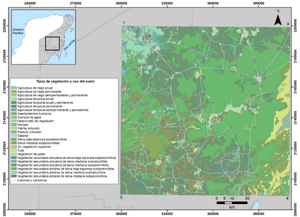
Comisión Nacional para el Conocimiento y Uso de la Biodiversidad (Conabio). 2023. Mapa de uso de suelo y vegetación Serie VII. Portal de Geoinformación 2023. Sistema Nacional de Información sobre Biodiversidad (SNIB). http://www.conabio.gob.mx/informacion/gis/. (7 de enero de 2024).
Dai, Z., R. A. Birdsey, K. D. Johnson, J. M. Dupuy, J. L. Hernandez-Stefanoni and K. Richardson. 2014. Modeling carbon stocks in a secondary tropical dry forest in the Yucatan Peninsula, Mexico. Water, Air, & Soil Pollution 225:1-15. Doi: 10.1007/s11270-014-1925-x. DOI: https://doi.org/10.1007/s11270-014-1925-x
Daniel, W. W. 1991. Bioestadística. Base para el análisis de las ciencias de la salud. Limusa-Waley. Cuauhtémoc, México D. F., México. 667 p.
Díaz, A., L. Sáenz-Zúñiga y B. Zutta. 2021. Formación de un humedal en la costa norte del Perú: estabilidad biofísica y diversidad biológica. Revista Peruana de Biología 28(3):1-10. Doi: 10.15381/rpb.v28i3.21132. DOI: https://doi.org/10.15381/rpb.v28i3.21132
Dupuy R., J. M., J. L. Hernández S., R. Hernández J., F. Tun D. y F. May P. 2012. Efectos del cambio de uso del suelo en la biomasa y diversidad de plantas leñosas en un paisaje de bosque tropical seco en Yucatán. Investigación Ambiental 4(1):130-140. https://cicy.repositorioinstitucional.mx/jspui/bitstream/1003/1242/1/id26022_Dupuy_Juan.pdf. (30 de octubre de 2023).
Durán-Medina, E., J. F. Mas y A. Velázquez. 2007. Cambios en las coberturas de vegetación y usos del suelo en regiones con manejo forestal comunitario y áreas naturales protegidas de México. In: Bray, D. B., L. Merino P. y D. Barry (Edits.). Los bosques comunitarios de México. Manejo sustentable de paisajes forestales. Instituto Nacional de Ecología (INE-Semarnat) y Consejo Civil Mexicano para la Silvicultura Sostenible (CCMSS). Coyoacán, México D. F., México. pp. 267-299.
Ellis, E. A., A. Navarro M., M. García O., I. U. Hernández G. and D. Chacón C. 2020. Forest cover dynamics in the Selva Maya of Central and Southern Quintana Roo, Mexico: deforestation or degradation? Journal of Land Use Science 15(1):25-51. Doi: 10.1080/1747423X.2020.1732489. DOI: https://doi.org/10.1080/1747423X.2020.1732489
Ellis, E. A., A. Navarro-Martínez and M. García-Ortega. 2021. Drivers of forest cover transitions in the Selva Maya, Mexico: Integrating regional and community scales for landscape assessment. Land Degradation & Development 32(10):3122-3141. Doi: 10.1002/ldr.3972. DOI: https://doi.org/10.1002/ldr.3972
Ellis, E. A., I. U. Hernández-Gómez y J. A. Romero-Montero. 2017. Los procesos y causas del cambio en la cobertura forestal de la Península Yucatán, México. Ecosistemas 26(1):101-111. Doi: 10.7818/ECOS.2017.26-1.16. DOI: https://doi.org/10.7818/ECOS.2017.26-1.16
Environmental System Research Institute (ESRI). 2015. ArcGIS version 10.4. Redlands, CA, United States of America. ESRI.
Estrada-Medina, H., V. Cobos-Gasca, J. L. Acosta-Rodríguez, S. Peña F., ... y R. L. Zapata-Luna. 2016. La sequía de la península de Yucatán. Tecnología y Ciencias del Agua 7(5):151-165. https://www.scielo.org.mx/pdf/tca/v7n5/2007-2422-tca-7-05-00151.pdf. (15 de abril de 2023).
Flachsenberg, H. y H. A. Galletti. 1999. El manejo forestal de la selva en Quintana Roo, México. In: Primack, R. B., D. Bray, H. A. Galletti e I. Ponciano (Edits.). La Selva Maya: conservación y desarrollo. Siglo XXI Editores. Coyoacán, México D. F., México. pp. 74-97.
García, E. 2004. Modificaciones al sistema de clasificación climática de Köppen. Instituto de Geografía de la Universidad Nacional Autónoma de México. Coyoacán, México D. F., México. 90 p.
Gilabert, M. A., J. González-Piqueras y J. García-Haro. 1997. Acerca de los índices de vegetación. Revista de Teledetección 8:1-10. https://www.researchgate.net/publication/39195330_Acerca_de_los_indices_de_vegetacion. (28 de julio de 2023).
Hammond, N. 1982. Ancient Maya civilization. Rutgers University Press. New Piscataway, NJ, United States of America. 348 p.
Hernández G., I. U. and E. A. Ellis. 2023. Selective logging and shifting agriculture may help maintain forest biomass on the Yucatan peninsula. Land Degradation & Development 34(14):4456-4471. Doi: 10.1002/ldr.4789. DOI: https://doi.org/10.1002/ldr.4789
Hernández-Gómez, I. U., C. R. Cerdán-Cabrera, A. Navarro-Martínez, D. Vázquez-Luna, S. Armenta-Montero and E. A. Ellis. 2019. Assessment of the CLASlite forest monitoring system in detecting disturbance from selective logging in the Selva Maya, Mexico. Silva Fennica 53(1):1-10. Doi: 10.14214/sf.10012. DOI: https://doi.org/10.14214/sf.10012
Hernández-Gómez, I. U., D. Vázquez-Luna, C. R. Cerdán-Cabrera, A. Navarro-Martínez and E. A. Ellis. 2020. Mapping disturbance from selective logging in tropical forest of the Yucatan Peninsula, México. Tropical and Subtropical Agroecosystems 23(1):1-19. Doi: 10.56369/tsaes.2952. DOI: https://doi.org/10.56369/tsaes.2952
Hernández-Ramos, J., X. García-Cuevas, R. Pérez-Miranda, A. González-Hernández y L. Martínez-Ángel. 2020. Inventario y mapeo de variables forestales mediante sensores remotos en el estado de Quintana Roo, México. Madera y Bosques 26(1):1-17. Doi: 10.21829/myb.2020.2611884. DOI: https://doi.org/10.21829/myb.2020.2611884
Hernández-Stefanoni, J. L., G. Reyes-Palomeque, M. Á. Castillo-Santiago, S. P. George-Chacón, … and J. M. Dupuy. 2018. Effects of sample plot size and GPS location errors on aboveground biomass estimates from LiDAR in tropical dry forests. Remote Sensing 10(10):1586. Doi: 10.3390/rs10101586. DOI: https://doi.org/10.3390/rs10101586
Hernández-Stefanoni, J. L., M. Á. Castillo-Santiago, J. Andres-Mauricio, C. A. Portillo-Quintero, F. Tun-Dzul and J. M. Dupuy. 2021. Carbon stocks, species diversity and their spatial relationships in the Yucatán Peninsula, Mexico. Remote Sensing 13(16):3179. Doi: 10.3390/rs13163179. DOI: https://doi.org/10.3390/rs13163179
Hernández-Stefanoni, J. L., M. Á. Castillo-Santiago, J. F. Mas, C. E. Wheeler, … and J. M. Dupuy. 2020. Improving aboveground biomass maps of tropical dry forests by integrating LiDAR, ALOS PALSAR, climate and field data. Carbon Balance and Management 15:1-17. Doi: 10.1186/s13021-020-00151-6. DOI: https://doi.org/10.1186/s13021-020-00151-6
Huchin O., S. A., A. Navarro-Martínez, E. A. Ellis e I. U. Hernández G. 2022. Deforestación en el municipio de Bacalar, Quintana Roo, México durante el período 1993-2017. Madera y Bosques 28(3):1-13. Doi: 10.21829/myb.2022.2832396. DOI: https://doi.org/10.21829/myb.2022.2832396
Huechacona-Ruiz, A. H., J. M. Dupuy, N. B. Schwartz, J. S. Powers, … and J. L. Hernández-Stefanoni. 2020. Mapping tree species deciduousness of tropical dry forests combining reflectance, spectral unmixing, and texture data from high-resolution imagery. Forest 11(11):1234. Doi: 10.3390/f11111234. DOI: https://doi.org/10.3390/f11111234
Instituto Nacional de Estadística y Geografía (Inegi). 2022. Índice de Vegetación de Diferencia Normalizada NDVI Landsat, 1984-2021. Aguascalientes, Ags., México. 7 p. https://www.inegi.org.mx/contenidos/productos/prod_serv/contenidos/espanol/bvinegi/productos/nueva_estruc/889463908272.pdf. (7 de enero de 2024).
Lemma, D. B., K. T. Gebretsadik and S. K. Debela. 2021. Forest cover change detection in relation to climate variability and LULC changes using GIS and RS techniques. A case of the Kafa zone, southwest Ethiopia. Journal of Water and Land Development (51):152-162. Doi: 10.24425/jwld.2021.139025. DOI: https://doi.org/10.24425/jwld.2021.139025
Manrique, E. G. 1999. Índice de vegetación. Aplicación del NDVI. In: Asociación Española de Teledetección (Edit.). Teledetección. Avances y Aplicaciones. VIII Congreso Nacional de Teledetección. Asociación Española de Teledetección. Albacete, AB, España. pp. 217-219.
Márdero, S., E. Nickl, B. Schmook, L. Schneider, … y D. Lawrence. 2012. Sequías en el sur de la península de Yucatán: análisis de la variabilidad anual y estacional de la precipitación. Investigaciones Geográficas (78):19-33. https://www.scielo.org.mx/pdf/igeo/n78/n78a3.pdf. (22 de abril de 2023). DOI: https://doi.org/10.14350/rig.32466
Millano-Tudare, J. L., F. J. Paredes-Trejo, E. Jaimes, N. Pineda, … e I. Pineda. 2017. Patrones fenológicos de cinco tipos de cobertura en bosque seco tropical, sur-cojedes, Venezuela. Revista Agrollania 14:106-112. http://www.postgradovipi.50webs.com/archivos/agrollania/2017/agro16.pdf. (14 de septiembre de 2023).
Moizo M., P. 2004. La percepción remota y la tecnología SIG: una aplicación en Ecología de Paisaje. GeoFocus Revista Internacional de Ciencia y Tecnología de la Información Geográfica (4):1-24. https://www.geofocus.org/index.php/geofocus/article/view/40. (12 de septiembre de 2023).
Navarro M., M. A. 2015. Diagnóstico del estado actual de Swietenia macrophylla King (caoba) en los bosques manejados de Quintana Roo, México: perspectivas para su manejo. Tesis de Doctorado. Centro de Investigaciones Tropicales, Universidad Veracruzana. Xalapa-Enríquez, Ver., México. 132 p.
Navarro M., M. A. y D. Granados S. 1997. Dinámica sucesional en un bosque tropical afectado por disturbios en la zona norte de Quintana Roo. Revista Chapingo Ciencias Forestales 1:5-16. https://es.scribd.com/document/456410413/rchscfaIII2164-pdf. (18 de agosto de 2023).
Navarro M., M. A., B. Schmook y J. Martínez C. 2000. Manejo tradicional de hubches en una comunidad maya de Quintana Roo. Foresta Veracruzana 2(1):19-30. https://www.redalyc.org/articulo.oa?id=49720102. (20 de agosto de 2023).
Navarro-Martínez, A., R. Durán-García y M. Méndez-González. 2012. El impacto del huracán Dean sobre la estructura y composición arbórea de un bosque manejado en Quintana Roo, México. Madera y Bosques 18(1):57-76. Doi: 10.21829/myb.2012.1811138. DOI: https://doi.org/10.21829/myb.2012.1811138
Navarro-Martínez, M. A. 2011. La caoba. Más de un siglo de aprovechamiento. In: Pozo, C., N. Armijo C. y S. Calmé (Edits.). Riqueza biológica de Quintana Roo. Un análisis para su conservación. Comisión Nacional para el Conocimiento y Uso de la Biodiversidad (Conabio), Colegio de la Frontera Sur (Ecosur) y Gobierno del Estado de Quintana Roo. Tlalpan, México D. F., México. pp. 212-220.
Parenti, M. S. 2015. Hurricane effects on mangrove canopies observed from MODIS and SPOT imagery. Cornell University. Ithaca, NY, United States of America. 48 p.
Pat-Aké, I., L. del C. Cámara-Cabrales, S. Ward, P. Martínez-Zurimendi, … y N. Sorensen. 2018. Efecto del huracán Dean en la dinámica estructural de selvas bajo manejo forestal en Quintana Roo, México. Madera y Bosques 24(2):1-17. Doi: 10.21829/myb.2018.2421585. DOI: https://doi.org/10.21829/myb.2018.2421585
Pettorelli, N., J. O. Vik, A. Mysterud, J. M. Gaillard, C. J. Tucker and N. C. Stenseth. 2005. Using the satellite-derived NDVI to assess ecological responses to environmental change. Trends in Ecology & Evolution 20(9):503-510. Doi: 10.1016/j.tree.2005.05.011. DOI: https://doi.org/10.1016/j.tree.2005.05.011
Rivera-Monroy, V. H., L. M. Farfán, L. Brito-Castillo, J. Cortés-Ramos, … and J. I. Euan-Ávila. 2020. Tropical cyclone landfall frequency and large-scale environmental impacts along Karstic Coastal Regions (Yucatan Peninsula, Mexico). Applied Sciences 10(17):5815. Doi: 10.3390/app10175815. DOI: https://doi.org/10.3390/app10175815
Rodstrom, C., S. Olivieri y L. Tangley. 1999. Un enfoque regional de la conservación en la Selva Maya. In: Primack, R. B., D. Bray, H. A. Galletti e I. Ponciano (Edits.). La Selva Maya: conservación y desarrollo. Siglo XXI Editores. Coyoacán, México D. F., México. pp. 23-42.
Ruiz D., M. E., M. E. Orozco H., R. Granados R. y G. Álvarez A. 2017. Cambio de uso de suelo e índice de vegetación de diferencia normalizada (NDVI), subcuenta del Río Salado, México. Geografía y Sistemas de Información Geográfica 9(9):39-50. http://ri.uaemex.mx/bitstream/handle/20.500.11799/68525/02%20Cambio%20de%20uso%20de%20suelo.pdf?sequence=1&isAllowed=y. (14 de abril de 2023).
Sánchez-Rivera, G. and L. Gómez-Mendoza. 2022. Tropical cyclone effects on vegetation resilience in the Yucatan Peninsula, México, between 2000-2012. Investigaciones Geográficas (77):203-220. Doi: 10.14198/INGEO.18499. DOI: https://doi.org/10.14198/INGEO.18499
Secretaría de Seguridad y Protección Ciudadana (SSPC) y Centro Nacional de Prevención de Desastres (Cenapred). 2021. Guía básica para la elaboración de Atlas Estatales y Municipales de peligros y riesgos. Evaluación de la vulnerabilidad física y social. SSPC y Cenapred. Coyoacán, Cd. Mx., México. 166 p. https://www.cenapred.unam.mx/es/Publicaciones/archivos/57.pdf. (20 de agosto de 2023).
Snook, L. K. 1993. Stand dynamics of mahogany (Swietenia macrophylla King) and associated species after fire and hurricane in the tropical forest of the Yucatan Peninsula, Mexico. Dissertation, Doctor of Forestry. Faculty of the School of Forestry and Environmental Studies, Yale University. 254 p.
Snook, L. K. 2005. Aprovechamiento sostenido de caoba en la Selva Maya de México. De la conservación fortuita al manejo sostenible. Recursos Naturales y Ambiente (44):9-18. https://www.cifor.org/publications/pdf_files/articles/ASnook0505.pdf. (12 de abril de 2023).
Suárez, E., A. M. Sánchez, E. F. Cabrera y T. Pulido. 1994. Estudio integral de la frontera México-Belice, Recursos Naturales. Centro de Investigaciones de Quintana Roo A. C. Chetumal, Q. Roo, México. 211 p.
Tecuapetla-Gómez, I., A. Carbajal-Domínguez y V. Montesinos-Chica. 2022. Clasificación de tendencias de NDVI en la Península de Yucatán, México, de 2014 a 2020. Investigaciones Geográficas (109):1-19. Doi: 10.14350/rig.60629. DOI: https://doi.org/10.14350/rig.60629
Tobasura M., D. 2017. Mitigación del cambio climático en Felipe Carrillo Puerto, México: Expectativas y divisiones por el territorio. Ecología Política (53):80-83. https://dialnet.unirioja.es/servlet/articulo?codigo=6063837. (15 de mayo de 2023).
Torres-Rojas, G., M. E. Romero-Sánchez, E. Velasco-Bautista y A. González-Hernández. 2016. Estimación de parámetros forestales en bosques de coníferas con técnicas de percepción remota. Revista Mexicana de Ciencias Forestales 7(36):7-24. Doi: 10.29298/rmcf.v7i36.56. DOI: https://doi.org/10.29298/rmcf.v7i36.56
Vázquez, P., E. Adema y B. Fernández. 2013. Dinámica de la fenología de la vegetación a partir de series temporales de NDVI de largo plazo en la provincia de La Pampa. Ecología Austral 23:77-86. http://www.scielo.org.ar/pdf/ecoaus/v23n2/v23n2a01.pdf. (13 de junio de 2023). DOI: https://doi.org/10.25260/EA.13.23.2.0.1163
Vega G., Á., J. López-García y L. de L. Manzo D. 2008. Análisis espectral y visual de vegetación y uso del suelo con imágenes Landsat ETM+ con apoyo de fotografías aéreas digitales en el Corredor Biológico Chichinautzin, Morelos, México. Investigaciones Geográficas Boletín del Instituto de Geografía (67):59-75. Doi: 10.14350/rig.17990.
Vester, H. F. M. y M. A. Navarro M. 2007. Árboles maderables de Quintana Roo: fichas ecológicas. El Colegio de la Frontera Sur (Ecosur), Consejo Nacional de Ciencia y Tecnología (Conacyt), Gobierno del Estado de Quintana Roo y Comisión Nacional para el Conocimiento y Uso de la Biodiversidad (Conabio). Chetumal, QR, México. 139 p.
Descargas
Publicado
Cómo citar
Número
Sección
Licencia
Derechos de autor 2024 Revista Mexicana de Ciencias Forestales

Esta obra está bajo una licencia internacional Creative Commons Atribución-NoComercial 4.0.
Los autores que publiquen en la Revista Mexicana de Ciencias Forestales aceptan las siguientes condiciones:
De acuerdo con la legislación de derechos de autor, la Revista Mexicana de Ciencias Forestales reconoce y respeta el derecho moral de los autores, así como la titularidad del derecho patrimonial, el cual será cedido a la revista para su difusión en acceso abierto.
Todos los textos publicados por la Revista Mexicana de Ciencias Forestales –sin excepción– se distribuyen amparados bajo la licenciaCreative Commons 4.0 Atribución-No Comercial (CC BY-NC 4.0 Internacional), que permite a terceros utilizar lo publicado siempre que mencionen la autoría del trabajo y a la primera publicación en esta revista. (no permite el uso comercial)
Los autores pueden realizar otros acuerdos contractuales independientes y adicionales para la distribución no exclusiva de la versión del artículo publicado en la Revista Mexicana de Ciencias Forestales (por ejemplo, incluirlo en un repositorio institucional o darlo a conocer en otros medios en papel o electrónicos) siempre que indique clara y explícitamente que el trabajo se publicó por primera vez en la Revista Mexicana de Ciencias Forestales.
Para todo lo anterior, los autores deben remitir el formato de carta-cesión de la propiedad de los derechos de la primera publicación debidamente requisitado y firmado por los autores/as. Este formato debe ser remitido en archivo PDF al correo: editorial.forestal@inifap.gob.mx
Esta obra está bajo una licencia de Creative Commons Reconocimiento-No Comercial 4.0 Internacional.