Classification of land use and vegetation with convolutional neural networks
DOI:
https://doi.org/10.29298/rmcf.v13i74.1269Keywords:
automatic classification, Atoyac-Salado River, machine learning, Sentinel-2 imagesAbstract
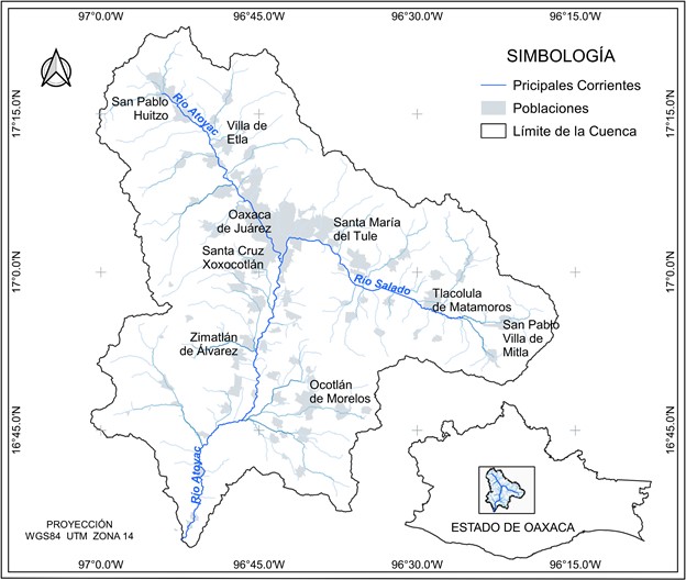
The classification of land use and vegetation is a complex and difficult exercise to perform with traditional methods, so deep learning models are an alternative for its application because they are highly capable of learning this complex semantics, which makes plausible its application in the automatic identification of land use and vegetation from spatio-temporal patterns extracted from their appearance. The objective was to propose and evaluate a deep learning convolutional neural network model for the classification of 22 different land cover and land use classes within the Atoyac-Salado river basin. The proposed model was trained using digital data captured in 2021 by the Sentinel 2 satellite, applying a different combination of hyperparameters, where the model accuracy depends on the optimizer, activation function, filter size, learning rate and batch size. The results provided an accuracy of 84.57% for the data set. To reduce overfitting, a regularization method called dropout was employed and proved to be very effective.
Downloads
References
Bhosle, K. and Musande, V. 2019. Evaluation of Deep Learning CNN Model for LULC Classification and Crop Identification Using Hyperspectral Remote Sensing Images. India. Journal of the Indian Society of Remote Sensing, 47(11):1949–1958. https://doi.org/10.1007/s12524-019-01041-2 DOI: https://doi.org/10.1007/s12524-019-01041-2
Bocco, M.; Ovando, G.; Sayago, S. and Willington, E. 2007. Neural Network Model for Land Cover Classification from Satellite Images. Arg. Agricultura Técnica, 67(4): 414–421. https://doi.org/10.4067/S0365-28072007000400009 DOI: https://doi.org/10.4067/S0365-28072007000400009
Borràs, J.; Delegido, J.; Pezzola, A.; Pereira, M.; Morassi, G. and Camps-Valls, G. 2017. Clasificación de usos del suelo a partir de imágenes Sentinel-2. Revista de Teledetección, 2017(48):55. https://doi.org/10.4995/raet.2017.7133 DOI: https://doi.org/10.4995/raet.2017.7133
Chen, Y.; Jiang, H.; Li, C.; Jia, X. and Ghamisi, P. 2016. Deep Feature Extraction and Classification of Hyperspectral Images Based on Convolutional Neural Networks. China. IEEE Transactions on Geoscience and Remote Sensing, 54(10):6232–6251. https://doi.org/10.1109/TGRS.2016.2584107 DOI: https://doi.org/10.1109/TGRS.2016.2584107
Congalton, R. G. and Green, K. 2009. Sample Design Considerations. United States of America in C. Press (Ed.), Assessing the Accuracy of Remotely Sensed Data: Principles and Practices, Second Edition. (63–83). https://doi.org/10.1201/9781420055139.ch5 DOI: https://doi.org/10.1201/9781420055139.ch5
DOF. 2017. Acuerdo por el que se dan a conocer los resultados del estudio técnico de las aguas nacionales superficiales en las cuencas hidrológicas Río Papagayo 1, Río Petaquillas, Río Omitlán, Río Papagayo 2, Río Papagayo 3, Río Papagayo 4, Río Nexpa 1 y 2. México. Diario Oficial de La Federación. https://dof.gob.mx/nota_detalle.php?codigo=5496053yfecha=04/09/2017
Drusch, M.; Del Bello, U.; Carlier, S.; Colin, O.; Fernandez, V.; Gascon, F.; Hoersch, B.; Isola, C.; Laberinti, P.; Martimort, P.; Meygret, A.; Spoto, F.; Sy, O.; Marchese, F. and Bargellini, P. 2012. Sentinel-2: ESA’s Optical High-Resolution Mission for GMES Operational Services. Netherlands. Remote Sensing of Environment, 120:25–36. https://doi.org/10.1016/j.rse.2011.11.026 DOI: https://doi.org/10.1016/j.rse.2011.11.026
Gascon, F.; Bouzinac, C.; Thépaut, O.; Jung, M.; Francesconi, B.; Louis, J.; Lonjou, V.; Lafrance, B.; Massera, S.; Gaudel-Vacaresse, A.; Languille, F.; Alhammoud, B.; Viallefont, F.; Pflug, B.; Bieniarz, J.; Clerc, S.; Pessiot, L.; Trémas, T.; Cadau, E. and Fernandez, V. Copernicus Sentinel-2A Calibration and Products Validation Status. France. Remote Sensing, 9(6):584. https://doi.org/10.3390/rs9060584 DOI: https://doi.org/10.3390/rs9060584
Gnip, P.; Vokorokos, L. and Drotár, P. 2021. Selective oversampling approach for strongly imbalanced data. Slovak Republic. PeerJ Computer Science, 7, e604. https://doi.org/10.7717/peerj-cs.604 DOI: https://doi.org/10.7717/peerj-cs.604
Hermosilla, T.; Wulder, M. A.; White, J. C. and Coops, N. C. 2022. Land cover classification in an era of big and open data: Optimizing localized implementation and training data selection to improve mapping outcomes. Remote Sensing of Environment, 268. https://doi.org/10.1016/j.rse.2021.112780 DOI: https://doi.org/10.1016/j.rse.2021.112780
Hu, F.; Xia, G. S.; Hu, J. and Zhang, L. 2018. A deep convolution neural network method for land cover mapping: A case study of Qinhuangdao, China. China. Remote Sensing, 10(12):1–17. https://doi.org/10.3390/rs10122053 DOI: https://doi.org/10.3390/rs10122053
INEGI. 2017. Guía para la interpretación de cartografía: uso del suelo y vegetación. México. Instituto Nacional de Estadística y Geografía, 204
Kingma, D. P. and Ba, J. 2014. Adam: A Method for Stochastic Optimization. 3rd International Conference on Learning Representations, ICLR, 1–15. http://arxiv.org/abs/1412.6980
Krizhevsky, A.; Sutskever, I. and Hinton, G. E. 2012. ImageNet Classification with Deep Convolutional Neural Networks. Canada. Advances in Neural Information Processing Systems, 25. http://www.cs.toronto.edu/~fritz/absps/imagenet.pdf
Lawley, V.; Lewis, M.; Clarke, K. and Ostendorf, B. 2016. Site-based and remote sensing methods for monitoring indicators of vegetation condition: An Australian review. Ecological Indicators, 60:1273–1283. https://doi.org/10.1016/j.ecolind.2015.03.021 DOI: https://doi.org/10.1016/j.ecolind.2015.03.021
Liu, R.; Yang, X.; Xu, C.; Wei, L. and Zeng, X. 2022. Comparative Study of Convolutional Neural Network and Conventional Machine Learning Methods for Landslide Susceptibility Mapping. China. Remote Sensing, 14(2):321. https://doi.org/10.3390/rs14020321 DOI: https://doi.org/10.3390/rs14020321
Macedo, A.; Pajares, G. y Santos, M. 2010. Clasificación no supervisada con imágenes a color de cobertura terrestre. México. Agrociencia, 44(6):711–722. https://www.redalyc.org/articulo.oa?id=30215554009
Mas, J. F.; Velázquez, A. y Couturier, S. 2009. La evaluación de los cambios de cobertura / uso del suelo en la República Mexicana. México. Investigación Ambiental, 1(1):23–39
Meyer, W. and Turner II, B. 1992. Human Population Growth and Global Land-Use/Cover Change. United States of America. Annual Review of Ecology and Systematics, 23:39–61 DOI: https://doi.org/10.1146/annurev.es.23.110192.000351
Najafabadi, M. M.; Villanustre, F.; Khoshgoftaar, T. M.; Seliya, N.; Wald, R. and Muharemagic, E. 2015. Deep learning applications and challenges in big data analytics. United States of America. Journal of Big Data, 2(1):1–21. https://doi.org/10.1186/s40537-014-0007-7 DOI: https://doi.org/10.1186/s40537-014-0007-7
Olofsson, P.; Foody, G. M.; Herold, M.; Stehman, S. V.; Woodcock, C. E. and Wulder, M. A. 2014. Good practices for estimating area and assessing accuracy of land change. Remote Sensing of Environment. Elsevier Inc. 148:42-57 https://doi.org/10.1016/j.rse.2014.02.015 DOI: https://doi.org/10.1016/j.rse.2014.02.015
Patel, S. K.; Verma, P. and Singh, G. S. 2019. Agricultural growth and land use land cover change in peri-urban India. Environmental Monitoring and Assessment 191(9):600. https://doi.org/10.1007/s10661-019-7736-1 DOI: https://doi.org/10.1007/s10661-019-7736-1
Paz, F.; Romero, V. M.; Argumedo-Espinoza, J. A.; Bolaños, M.; de Jong, B.; de la Cruz, J. C. y Velázquez, A. 2019. Dinámica Del Uso Del Suelo Y Vegetación. México. In Estado del Ciclo del Carbono en México, Agenda Azul y Verde (Vol. 23, Issue June. 529–572)
Pellikka, P. K. E.; Clark, B. J. F.; Gosa, A. G.; Himberg, N.; Hurskainen, P.; Maeda, E.; Mwang’ombe, J.; Omoro, L. M. A. and Siljander, M. 2013. Agricultural Expansion and Its Consequences in the Taita Hills, Kenya. In Developments in Earth Surface Processes. Elsevier. 16:65–179. https://doi.org/10.1016/B978-0-444-59559-1.00013-X DOI: https://doi.org/10.1016/B978-0-444-59559-1.00013-X
Ponce, J. C.; Torres, A.; Quezada, F. S.; Silva, A.; Martínez, E. U.; Casali, F. A.; Scheihing, E.; Túpac, Y. J.; Torres, M. D.; Ornelas, F. J.; Hernández, J. A.; Zavala, C.; Vakhni, N. y Pedreño, O. 2014. Inteligencia Artificial. In Iniciativa Latinoamericana de Libros de Texto Abiertos (Vol. 1)
Rousset, G.; Despinoy, M.; Schindler, K. and Mangeas, M. 2021. Assessment of deep learning techniques for land use land cover classification in southern new caledonia. France. Remote Sensing, 13(12):1–22. https://doi.org/10.3390/rs13122257 DOI: https://doi.org/10.3390/rs13122257
Sarker, I. H. 2021. Machine Learning: Algorithms, Real-World Applications and Research Directions. Australia. SN Computer Science, 2(3)160. https://doi.org/10.1007/s42979-021-00592-x DOI: https://doi.org/10.1007/s42979-021-00592-x
Shalev, S. and Ben, S. 2014. Understanding machine learning: From theory to algorithms. United States of America. In Understanding Machine Learning: From Theory to Algorithms. https://doi.org/10.1017/CBO9781107298019 DOI: https://doi.org/10.1017/CBO9781107298019
Srivastava, N.; Hinton, G.; Krizhevsky, A.; Sutskever, I. and Salakhutdinov, R. 2014. Dropout: A Simple Way to Prevent Neural Networks from Overfitting. Canada, Journal of Machine Learning Research, 15:1929–1958
Suárez, A. S.; Jiménez, A. F.; Castro, M. y Cruz, A. A. 2017. Clasificación y mapeo automático de coberturas del suelo en imágenes satelitales utilizando Redes Neuronales Convolucionales. Colombia. Orinoquia, 21(1 Sup):64–75. https://doi.org/10.22579/20112629.432 DOI: https://doi.org/10.22579/20112629.432
Theodoridis, S. 2015. Introduction. Netherlands. In Machine Learning (1–8). Elsevier. https://doi.org/10.1016/B978-0-12-801522-3.00001-X DOI: https://doi.org/10.1016/B978-0-12-801522-3.00001-X
Verona, P.; Cristina, I. y García, A. 2016. Una revisión sobre aprendizaje no supervisado de métricas de distancia. Cuba. Revista Cubana de Ciencias Informáticas, 10(4):43–67
Vinet, L. and Zhedanov, A. 2011. A ‘missing’ family of classical orthogonal polynomials. Canada. Journal of Physics A: Mathematical and Theoretical, 44(8). https://doi.org/10.1088/1751-8113/44/8/085201 DOI: https://doi.org/10.1088/1751-8113/44/8/085201
Xie, Z.; Chen, Y.; Lu, D.; Li, G. and Chen, E. 2019. Classification of Land Cover, Forest, and Tree Species Classes with ZiYuan-3 Multispectral and Stereo Data. Remote Sensing, 11(2):164. http://dx.doi.org/10.3390/rs11020164 DOI: https://doi.org/10.3390/rs11020164
Xie, G.; Shangguan, A.; Fei, R.; Ji, W.; Ma, W. and Hei, X. 2020. Motion trajectory prediction based on a CNN-LSTM sequential model. Science China Information Sciences, 63(11):1-21. https://doi.org/10.1007/s11432-019-2761-y DOI: https://doi.org/10.1007/s11432-019-2761-y
Yeturu, K. 2020. Machine learning algorithms, applications, and practices in data science. India. In Handbook of Statistics (1st ed., Vol. 43, 81–206). Elsevier B.V. https://doi.org/10.1016/bs.host.2020.01.002 DOI: https://doi.org/10.1016/bs.host.2020.01.002
Zhang, C.; Sargent, I.; Pan, X.; Li, H.; Gardiner, A.; Hare, J. and Atkinson, P. M. 2019. Joint Deep Learning for land cover and land use classification. United Kindom. Remote Sensing of Environment, 221:173–187. https://doi.org/10.1016/j.rse.2018.11.014 DOI: https://doi.org/10.1016/j.rse.2018.11.014
Published
How to Cite
Issue
Section
License
Copyright (c) 2022 Revista Mexicana de Ciencias Forestales

This work is licensed under a Creative Commons Attribution-NonCommercial 4.0 International License.
The authors who publish in Revista Mexicana de Ciencias Forestales accept the following conditions:
In accordance with copyright laws, Revista Mexicana de Ciencias Forestales recognizes and respects the authors’ moral right and ownership of property rights which will be transferred to the journal for dissemination in open access.
All the texts published by Revista Mexicana de Ciencias Forestales –with no exception– are distributed under a Creative Commons License Attribution-NonCommercial 4.0 International (CC BY-NC 4.0), which allows third parties to use the publication as long as the work’s authorship and its first publication in this journal are mentioned
The author(s) can enter into independent and additional contractual agreements for the nonexclusive distribution of the version of the article published in Revista Mexicana de Ciencias Forestales (for example, include it into an institutional repository or publish it in a book) as long as it is clearly and explicitly indicated that the work was published for the first time in Revista Mexicana de Ciencias Forestales.
For all the above, the authors shall send the form of Letter-transfer of Property Rights for the first publication duly filled in and signed by the author(s). This form must be sent as a PDF file to: ciencia.forestal2@inifap.gob.mx
This work is licensed under a Creative Commons Attribution-Noncommercial 4.0 International license.