Sistema de monitoreo meteorológico en un bosque templado a partir de análisis del paisaje
DOI:
https://doi.org/10.29298/rmcf.v13i74.1260Palabras clave:
calibración, estaciones meteorológicas, instalación, relieve, representatividad, unidades cartográficasResumen
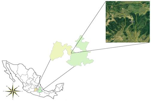
El monitoreo de variables meteorológicas es importante para el estudio de procesos biofísicos como el desarrollo y crecimiento de plantas, captura y retención de agua, aumento de nutrientes y aprovechamiento de servicios ambientales. El objetivo del estudio fue proponer un sistema de monitoreo meteorológico a partir del análisis del medio natural que proporcione una base de datos representativa. La propuesta se desarrolló en la Estación Forestal Experimental Zoquiapan, en el centro de México. El método incluyó la representatividad de las condiciones biofísicas en un bosque con clima templado semifrío. Primero, se generaron mapas de geoformas, clima y vegetación para delimitar las unidades cartográficas homogéneas de paisaje. Posteriormente, mediante criterios de emplazamiento, se seleccionaron tres unidades cartográficas para el establecimiento de tres estaciones meteorológicas. Los resultados incluyeron la caracterización del paisaje, así como la propuesta para establecer las estaciones meteorológicas. El sistema se integró con dos estaciones automáticas Davis Instruments y otra que opera con microcontrolador de código abierto Arduino. Los datos se recuperan mensualmente en una computadora portátil con cable USB. Antes de la instalación de las estaciones, las mediciones dadas por los sensores se compararon con los valores de una estación de referencia. Los datos de los primeros días de operación revelaron diferencias en las variables de las unidades de paisaje, y se concluye que ubicar las estaciones en una trayectoria altitudinal puede contribuir a relacionar el clima con diferente vegetación y geoformas.
Descargas
Citas
Adepoju, T. M., M.Oladele, A.Kasali and G.Fabiyi. 2020. Development of a Low-Cost Arduino-Based Weather Station. FUOYE Journal of Engineering and Technology 5(2): 69-73. http://dx.doi.org/10.46792/fuoyejet.v5i2.508 DOI: https://doi.org/10.46792/fuoyejet.v5i2.508
Blanco, S., G. Ceballos, C. Galindo, J. M. Maass, R. Patrón, A. Pescador and I. Suarez A. 1981. Ecología de la estación experimental Zoquiapan: descripción general, vegetación y fauna (1a ed.). México: Serie Agronomía 2, Universidad Autónoma Chapingo. 114 p.
G. Corvino, A. Lessio and E. Borgogno-Mondino, "Monitoring Rice Crops in Piemonte (Italy): Towards an Operational Service Based on Free Satellite Data," IGARSS 2018 - 2018 IEEE International Geoscience and Remote Sensing Symposium, 2018, pp. 9070-9073, doi: 10.1109/IGARSS.2018.8518634. DOI: https://doi.org/10.1109/IGARSS.2018.8518634
DAVIS. 2015. Weather Instruments. Retrieved from: http://www.davisnet.com/weather-monitoring/ (Consulted on october 20, 2019).
Ferdoush, S. and X. Li. 2014. Wireless sensor network system design using raspberry Pi and arduino for environmental monitoring applications. Procedia Computer Science, 34: 103-110. http://doi.org/10.1016/j.procs.2014.07.059 DOI: https://doi.org/10.1016/j.procs.2014.07.059
Faugel, H., and Bobkov, V. (2013). Open source hard- and software : Using arduino boards to keep old hardware running. Fusion Engineering and Design, 88, 1276–1279. http://doi.org/10.1016/j.fusengdes.2012.12.005 DOI: https://doi.org/10.1016/j.fusengdes.2012.12.005
García, E. 2004. Modificaciones al sistema de clasificación climática de Köppen. (5a ed.). México: Instituto de Geografía de la UNAM. Ciudad de México, México. 91 p.
Gómez J., D., D. Etchevers J., I. Monterroso A., C. Gay, J. Campo and M. Martínez. 2008. Spatial estimation of mean temperature and precipitation in areas of scarce meteorological information. Atmósfera, 21(1), 35-56. Retrieved from https://www.revistascca.unam.mx/atm/index.php/atm/article/view/8596
Gómez M., L. and L. Arriaga. 2007. Modeling the effect of climate change on the distribution of oak and pine species of Mexico. Conservation Biology, 21(6), 1545-1555. http://doi.org/10.1111/j.1523-1739.2007.00814.x DOI: https://doi.org/10.1111/j.1523-1739.2007.00814.x
Instituto Mexicano de Tecnología del Agua (IMTA). 2006. Extractor rápido de información climática (ERIC) versión 3. México: Servicio Meteorológico Nacional. Instituto Mexicano de Tecnología del Agua
Instituto Nacional de Ecología (INE). 2010. Manual 4. Operación de estaciones de medición de la calidad del aire, mantenimiento y calibración de sus componentes (1a ed.). México: Instituto Nacional de Ecología. 75p.
Instituto Nacional de Estadística, Geografía e Informática (INEGI). 2016a. Cuerpos de agua. Instituto Nacional de Estadística y Geografía. Retrieved from: http://www.inegi.org.mx/geo/contenidos/recnat/hidrologia/infoescala.aspx (Consulted on july 18, 2016)
Instituto Nacional de Estadística, Geografía e Informática (INEGI). 2016b. Estructuras geológicas. Instituto Nacional de Estadística y Geografía. Retrieved from: http://www.inegi.org.mx/geo/contenidos/recnat/geologia/infoescala.aspx (Consulted on july 18, 2016)
Instituto Nacional de Estadística, Geografía e Informática (INEGI). 2016c. Modelo de elevación digital. Instituto Nacional de Estadística y Geografía. Retrieved from: http://www.inegi.org.mx/geo/contenidos/datosrelieve/continental/Descarga.aspx (Consulted on july 18, 2016)
Instituto Nacional de Estadística, Geografía e Informática (INEGI). 2016d. Uso de suelo y vegetación. Instituto Nacional de Estadística y Geografía Retrieved from: http://www.inegi.org.mx/geo/contenidos/recnat/usosuelo/ (Consulted on august 22, 2016)
International Soil Reference and Information Centre (ISRIC). 2005. Updated global and national soils and terrain digital databases (SOTER). International Soil Reference and Information Centre. https://www.isric.org/sites/default/files/isric_report_2013_04.pdf (Consulted on august 22, 2016)
Juárez, A., C.Gay and Y. Flores. 2005. Impact of the Popocatepetl's volcanic activity on the air quality of Puebla City, México. Atmósfera, 18(1), 57-69. Retrieved from https://www.revistascca.unam.mx/atm/index.php/atm/article/view/8537
Katyal, A., R. Yadav and M. Pandey. 2016. Wireless Arduino Based Weather Station. International Journal of Advanced Research in Computer and Communication Engineering 5(4): 274-276, Retrieved from:https://www.ijarcce.com/upload/2016/april-16/IJARCCE%2070.pdf (Consulted on july 18, 2016).
Li, D. 2014. Assessing the impact of interannual variability of precipitation and potential evaporation on evapotranspiration. Advances in Water Resources, 70, 1-11. http://doi.org/10.1016/j.advwatres.2014.04.012 DOI: https://doi.org/10.1016/j.advwatres.2014.04.012
Lin, Y. and E.Zini. 2008. Free/libre open source software implementation in schools: Evidence from the field and implications for the future. Computer & education, 50, 1092-1102. http://doi.org/10.1016/j.compedu.2006.11.001 DOI: https://doi.org/10.1016/j.compedu.2006.11.001
Lomas-Barrié, C. T., Terrazas-Domínguez, S., & Tchikoué-Maga, H. (2005). Proposal of territorial ecological ordering for the National Park Zoquiapan and annex. Revista Chapingo Serie Ciencias Forestales y del Ambiente, 11(1), 57–71. Retrieved from https://revistas.chapingo.mx/forestales/?section=articles&subsec=issues&numero=31&articulo=431
Martínez del Castillo, E., Serrano Notivoli, R., Novak, K., Longares, L. A., Arrechea, E., Luis Arrillaga, M. D., & Saz-Sánchez, M. Á. (2012). Cuantificación de los gradientes climáticos altitudinales en la vertiente norte del Macizo del Moncayo a partir de una nueva red de estaciones automáticas en altura. Publicaciones de la Asociación Española de Climatología. Serie A; 8. http://hdl.handle.net/20.500.11765/8316
Martínez-Santiago, S., Alvarado-Segura, A., Zamudio-Sánchez, F., & Cristobal-Acevedo, D. (2017). Spatiotemporal analysis of forest modeling in Mexico. Revista Chapingo Serie Ciencias Forestales y del Ambiente, 23(1), 5–22. doi: 10.5154/r.rchscfa.2016.01.003 DOI: https://doi.org/10.5154/r.rchscfa.2016.01.003
Meulenert P., Á. R., H. U. Ramírez-Sánchez, F. O. García-Concepción, M. E. García-Guadalupe y J. Alcalá-Gutiérrez. 2005. Implementación de un sistema de alerta temprana contra fenómenos meteorológicos extremos e incendios forestales del Área Natural Protegida «Bosque de la Primavera» Jalisco, México, como parte de un proyecto de desarrollo y monitoreo sistemático e integral. México: Instituto de Astronomía y Meteorología, Universidad de Guadalajara.
Paredes-González, A., Monterroso-Rivas, A. I., Rodríguez-Esparza, L. J., and Zamudio-Sánchez, F. J. (2018). Projection and probability of land use change in Zoquiapan, Mexico: considerations for forest management. Revista Chapingo Serie Ciencias Forestales y del Ambiente, 24(1), 59-71. doi: 10.5154/r.rchscfa.2017.07.041 DOI: https://doi.org/10.5154/r.rchscfa.2017.07.041
Pompa G., M., F. J. Rodríguez F., C. A. Aguirre S. y L. Miranda A. 2013. Influencia de la evaporación en el crecimiento forestal. Agrociencia, 47(8), 829-836. https://www.agrociencia-colpos.mx/index.php/agrociencia/article/view/1059
Reyes A., G., S. Adame M. y E. Cadena V. 2018. Vulnerabilidad ante la variabilidad climática en los cultivos de maíz Zea mays. Sociedad y Ambiente, 6(17):93-113. ISSN:2007-6576 https://doi.org/10.31840/sya.v0i17.1842 DOI: https://doi.org/10.31840/sya.v0i17.1842
Romo J., R. y R. Arteaga. 1989. Meteorología agrícola. México: Departamento de irrigación, Universidad Autónoma Chapingo.
Sparkfun. 2013. Sparkfun. Retrieved from: https://learn.sparkfun.com/tutorials/weather-shield-hookup-guide (Consulted on october 17, 2016).
Stallman, R. M. 2004. Software libre para una sociedad libre. Madrid, España: Traficantes de sueños. Retrieved from: https://www.gnu.org/philosophy/fsfs/free_software.es.pdf (Consulted on july 18, 2016).
Torres-Quezada, J., Coch, H., and Isalgué, A. (2021). Data set of climatic factors measured in a low latitude region with warm and humid climate: Solar radiation, cloud cover and sky temperature. Data in Brief, 38:107404. https://doi.org/10.1016/J.DIB.2021.107404 DOI: https://doi.org/10.1016/j.dib.2021.107404
World Meteorological Organization (WMO). 2008. Guía de instrumentos y métodos de observación meteorológicos (No. 8). Suiza: World Meteorological Organization. Retrieved from: https://library.wmo.int/doc_num.php?explnum_id=3664 (Consulted on july 18, 2016).
Yang, C. H., and Regan, A. C. (2014). Methodology for the prioritization of environmental sensor station installation (case study of South Korea). Transport Policy, 32, 53–59. http://doi.org/10.1016/j.tranpol.2013.12.012 DOI: https://doi.org/10.1016/j.tranpol.2013.12.012
Descargas
Publicado
Cómo citar
Número
Sección
Licencia
Derechos de autor 2022 Revista Mexicana de Ciencias Forestales

Esta obra está bajo una licencia internacional Creative Commons Atribución-NoComercial 4.0.
Los autores que publiquen en la Revista Mexicana de Ciencias Forestales aceptan las siguientes condiciones:
De acuerdo con la legislación de derechos de autor, la Revista Mexicana de Ciencias Forestales reconoce y respeta el derecho moral de los autores, así como la titularidad del derecho patrimonial, el cual será cedido a la revista para su difusión en acceso abierto.
Todos los textos publicados por la Revista Mexicana de Ciencias Forestales –sin excepción– se distribuyen amparados bajo la licenciaCreative Commons 4.0 Atribución-No Comercial (CC BY-NC 4.0 Internacional), que permite a terceros utilizar lo publicado siempre que mencionen la autoría del trabajo y a la primera publicación en esta revista. (no permite el uso comercial)
Los autores pueden realizar otros acuerdos contractuales independientes y adicionales para la distribución no exclusiva de la versión del artículo publicado en la Revista Mexicana de Ciencias Forestales (por ejemplo, incluirlo en un repositorio institucional o darlo a conocer en otros medios en papel o electrónicos) siempre que indique clara y explícitamente que el trabajo se publicó por primera vez en la Revista Mexicana de Ciencias Forestales.
Para todo lo anterior, los autores deben remitir el formato de carta-cesión de la propiedad de los derechos de la primera publicación debidamente requisitado y firmado por los autores/as. Este formato debe ser remitido en archivo PDF al correo: editorial.forestal@inifap.gob.mx
Esta obra está bajo una licencia de Creative Commons Reconocimiento-No Comercial 4.0 Internacional.